
RESULTS - Lindsay Park WEO #16 Wednesday Evening series
August 24th 2022 6:30pm - 8:00pm
Organizers: Andrew McLaren (Course Planner), Andrew McLaren (Event Director)
Map: Lindsay Park
**Lost and Found** - contact event organizer for return
- Black Orienteering Canada Buff
Due to a large festival currently occupying Fort Calgary, this Wednesday's event will be held at Lindsay Park. The check-in desk is west of the playground, which is west of the MNP Community & Sport Center (formerly Repsol Centre, formerly Talisman Centre). Parking is usually available at the MNP centre or the park is well-connected to bike paths.
Pre-registration is required for all Wed night events and should be done by Monday night. We will print a few extra maps for late registrations but if there are too many we run out of maps (or waste a lot of paper), so please register by Monday night for every Wednesday night event.
If you wish to change which course you are registered for, you can log into 2mev.com and edit your course selected in your Event Registrations in the upper-right corner.
Map Notes:
- Typical park/city sprint terrain.
- The major roads are marked as out of bounds
- Watch out for olive green areas and uncrossable fences
- The river is uncrossable as per usual
- The map has had a few small updates but it is quite old so some areas may not be mapped properly
- The map is mapped to the old ISSOM standard
Preliminary Course Notes:
**Lengths are measured as the shortest route around all impassable objects**
Beginner | ~1.40km | 15 Controls
- The beginner course does not cross any roads and stays within the park
- Offers straightforward navigation for those new to the sport
Intermediate | ~4.54km | 18 Controls
- The intermediate course is quite similar to the advanced course but is shorter.
- The course crosses many small roads and parking lots so watch out for cars.
- Checking Control descriptions will be very important at some controls
Advanced | ~6.85km | 29 Controls
- A fair bit longer than your usual sprint race so don’t go out too hard.
- The course crosses many small roads and parking lots so watch out for cars.
- Checking Control descriptions will be very important at some controls
- Includes artificial barriers (see example below)

- Includes a map flip
Event Map:
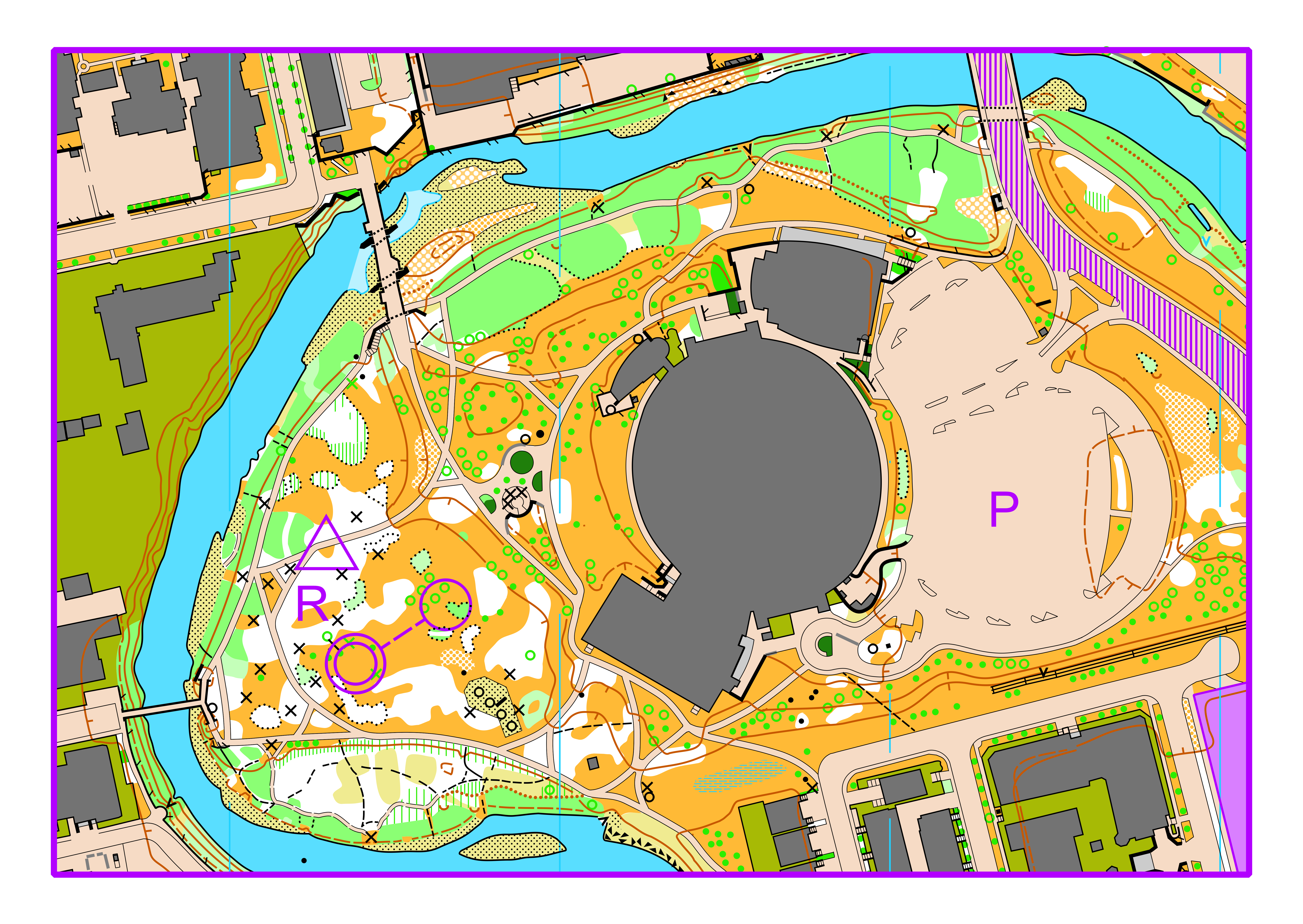
Check-in will not be next to the parking area so we have provided an overview of the area. Alternatively, the pin on the google map at the bottom of the page leads there as well.
Parking (P), Check-in (R), start, and Finish
Wednesday Evening Orienteering (WEO) event. Things to know:
- In-person orienteering with control flags and SI units in the terrain from 6:30-8pm on the day of the event.
- Start location identified in map below.
- We will be using SI sticks; you can borrow one on the night of the event if you do not own one.
- You will have to pre-register for the events.
- You will need to be a 2022 member of Foothills Orienteering (FWOC) or another Canadian orienteering club.
- We will be using Maprun6 so you can run anytime if you do not want to run on the evening of the event.