
RESULTS ! Paskapoo Slopes Forest Event
June 12th 2022 10:00am - 2:00pm
Organizers: Marion O (Course Planner), Teresa (Controller)
Map: Paskapoo Slopes
Thank you Volunteers!!
A big thank you to all of our volunteers: Marion for planning super fun courses and organizing everything, Marsha for registration, Philippa, Kurt, Janet, Jim, Lucas and David C. for setting up and running the start, Don, Nicki, Ben and Lucas for picking up controls. And Teresa forgot to thank herself! She updated the map and helped put out the controls very early this morning!! :)
And thank you to all the participants for making it an event.
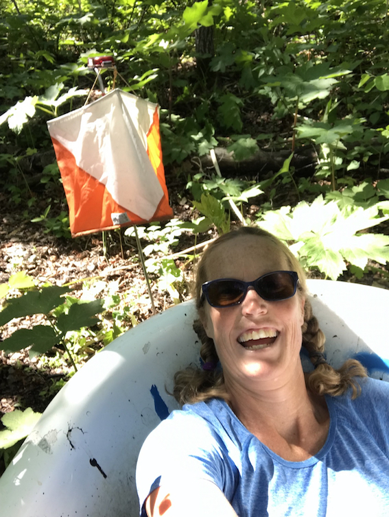
Good spot to rest at the first control
UPDATE - June 5
Courses are all set and ready to go!!! Check out the photos at the bottom of the page.
IMPORTANT NOTE: this is a very popular area for biking - please watch out for cyclists while on course and be courteous
Also watch out for other park users including dogs
PARKING OPTIONS:
- The Paskapoo parking lot we will be based at, called 'Olympic park parking' on google
- Street parking on the west side of Piita Rise SW (adjacent)
- Underground parking lot at Trinity Hills Shopping Mall (300m away)
- Street parking on Na'a Drive SW (400+m)
- Overground or Underground parking at Trinity Hill Tipi Plaza - Save on Foods, off Na'a Drive SW (1km)
There is no toilet or outhouse at the event site. Please plan ahead!
Join us to get in a little extra forest orienteering (in the city!) in preparation for the big events in July. Come run on the recently remapped Paskapoo Slopes (thank you Teresa!).
Paskapoo Slopes are really interesting with a lot of history. Here is a link to an article about the old homestead:
https://m.facebook.com/savepaskapooslopes/posts/83...
And a video detailing some more of the history of the area:
"Paskapoo Slopes" by Paskapoo Slopes Preservation Society 2000
It will be a barebones-type start, probably a remote start to give you practice for WCOCs. No water on the courses or at the finish so bring your own. There will be significant climb on the advanced courses. Shoes with an aggressive tread or spikes are recommended! And leg cover, as there are a few rose bushes! Check back soon to get more details and a more accurate course length and climb. Registration will be put up when the courses have been planned.
The start window will be 10-11:30, with an organised start in the first hour. So do come then!
REGISTER BY MIDNIGHT ON FRIDAY, JUNE 10TH!
Courses:
Beginner: 2.3 km, 40 m of climb. All on trails. 1:5,000
Novice: 2.9km, 95 m of climb. All on trails, some route decisions. 1:5,000.
Intermediate: 3 km, 135m of climb. Lots of trails but opportunities to take shortcuts. 1:7,500.
Short Advanced: 4.5km, 270 m of climb. 1:7,500
Long Advanced: 6.4 km, 385 m of climb. 1:7,500
Map Notes
The Paskapoo Slopes map was originally made in 2002 by Thomas Nipen. Since then there has been significant development (ongoing). The map has been updated and expanded to the south in 2022. Scale is 1:7500 with 5m contours.
The area is bounded by the Trans-Canada Highway and the community of Medicine Hills to the north, the communities of Cougar Ridge and Patterson to the south, Canada Olympic Park to the west and Sarcee Trail to the east. From the Trans-Canada the slopes rise by more than 100m to the south edge of the map. The lower half of the slopes is intersected by numerous steep ridges and ravines, with many natural springs. Much of the area has thick vegetation of poplar and aspen with bushy undergrowth. Larger ridges tend to be open grassland. There are also open areas on the flatter part of the upper slopes, where treed areas may also be less thickly vegetated. There are a few small rocky outcrops. There is a dense trail network frequented by cyclists, walkers, runners and dogs. A moose has been spotted several times during mapping.
Large individual spruce are shown by green/white circles on the map. Forts are black circles and the 'T' tower symbol is used for treehouses. Note some of these forts are temporary and can disappear or move from time to time. The black 'x' symbol is used for vehicle wrecks, large prominent posts/signs, and other man made objects.
Also of note is that numerous barbed wire fences are situated along current and former property lines. These are mapped and most are easy to cross. Many are broken down and mapped using the 'ruined fence' symbol. This is shown on the map legend along with the other special symbols noted above. These ruined barbed wire fences are easy to cross but difficult to see as the wire often runs along the ground, partially covered by vegetation. Lines of fence posts where the wire has been completely removed are not shown on the map.