
AOC Alberta Orienteering Championships 2015
September 19th 2015 10:00am - September 20th 2015 2:00pm
Organizers: Christin Lundgren (Course Planner), Andree Powers (Controller), Marion O (Controller), Jane R (Controller), Marsha Fehr (Event Director), Eileen Charles (Course Planner), magali robert (Course Planner)
FWOC is happy to host the 2015 Alberta Orienteering Championships. There will be three events. The sprint and middle are in Calgary and the long is just south of Calgary, near Turner Valley. Deadline for registration extended! Registration NOW closes on Thursday, September 17, at 4PM.
VOLUNTEERS - Volunteers play a crucial role in making every event run smoothly. Many of the meet roles require little training, and you can still participate:) If you'd like to volunteer, please contact Marsha Fehr at [email protected]. We are still looking for volunteers to help with Control Pick-up after each event. We also need a volunteer for the on-site registration table.
Event 1 - The Sprint - Voiter's Flats, Fish Creek Park: Christin Lundgren, Course Planner; Marion Owen, Controller
Results: http://obasen.orientering.se/winsplits/online/en/show_event.asp?id=38822
The AOC Sprint will take place on September 19 at 10AM in Fish Creek park at Voiter's Flats. As the name suggests, it is a flat area and there will be limited elevation. The path system is intricate and forces you to stay focused for every minute of your 12+ minute race. Parking is at Voiter's Flats. Toilets are close to the parking lot.
Cougar Alert: Please note that there were two cougar sightings at Fish Creek Park near Voiter's Flats (west of the Glennfield part of the park) last week. A Fish Creek Park conservation officer has been consulted. He reminds us that cougars are elusive and will move away out of choice. We recommend you read the Alberta Parks cougar bulletin here. We will consult with the Officer again on Friday, and you can keep an eye on their website: http://www.albertaparks.ca/
- START: First start will be at 10AM; Start window closes at 11AM.
- Start punch will be used.
- Start when ready at discretion of Start Chief.
- 3 competitors (on different courses) can start at the same time.
- Course closes at NOON.
Course Notes:
- The paths are mostly as represented on the map but you may expect some subtle discrepancies.
- The area is heavily used by hikers/runners/cyclists so please pay attention and share the paths.
- The area is wetter than the map suggests but we have generally avoided the really wet parts.
Course lengths are as follows:
Course 1, 1.3 km, W12 ,M12, W13-14, M13-14
Course 2, 1.8 km, W55-64,65-74,75-79,80-84,85+,
Course 3, 2.2 km, W45-54, M55-64, M65-74
Course 4, 2.3 km, W15-16, M15-16, W 17-20, W 21-34E, W 35-44
Course 5, 2.7 km, M17-20, M21-34E, M35-44, M45-54
RWT 10-12 min for course 1, 12-15 min all the rest except M 45 - 15+ min
Event 2 - The Middle - Bowmont Park Map: Magali Robert, Course Planner, Marion Owen, Controller
Results: http://obasen.orientering.se/winsplits/online/en/show_event.asp?id=38823
The Middle event for the 2015 AOCs will take place on the east end of Bowmont Park at 2PM. Please park along the park side of 40 Ave NW west of 53 Street NW. The start will be at the west end of the street. There is only street parking so please consider carpooling to this location. There will be NO toilets. Marketmall is very close to the event and an ideal option for those in need prior to the event. Washrooms at Marketmall are located south of the Gap close to the west entrance and in the food court by the east entrance. Magali has also offered the bathroom in her house (about 500m from the start) should it be needed.
- START: First start will be at 2PM; Start window closes at 3PM.
- Start punch will be used.
- Start when ready at discretion of Start Chief.
- 3 competitors (on different courses) can start at the same time.
- Course closes at 5PM.
Course Notes:
- Benches and garbage disposable units are not on the map.
- Wooden posts to delineate on-leash and off-leash dog areas are not mapped.
- Temporary fences around the start and finish are not on the map but should not affect route choices.
- On the map there is a fence around the dry water containment pond near the finish. The fence has been removed but should not affect route choices.
- Green dots on the map are usually distinct bushes not trees.
- On course 7: the electrical and power lines are not mapped.
Course 1: 1.6 km, W12, M12
Course 2: 1.7 km, W13-14, M13-14
Course 3: 2.4 km, W15-16, M15-16
Course 4: 2.3 km, W65-74, W75+, M80+
Course 5: 3.6 km, W45-54, W55-64, M65-74, M75-79
Course 6: 4.4 km, M17-20, W17-20, W21-34E, W35-44, M45-54, M55-64
Course 7: 5.9 km, M21-34E, M35-44
Barebones Social: In keeping with the barebones cost of the event, we are planning a potluck social after the middle event at Magali's house, starting about 5. Please plan to join us. Bring a dish for 8 to share and something to drink. To avoid leaving volunteers with a load of dishes to wash, please BYO (Bring Your Own) plate, cutlery and cup. More details to come - stay tuned. Directions/map to Magali's house will be at the registration table.
Event 3 - The Long Event - Sandy McNabb Map: Eileen Charles, Course Planner, Andree Powers, Controller
Results: http://obasen.orientering.se/winsplits/online/en/show_event.asp?id=38824
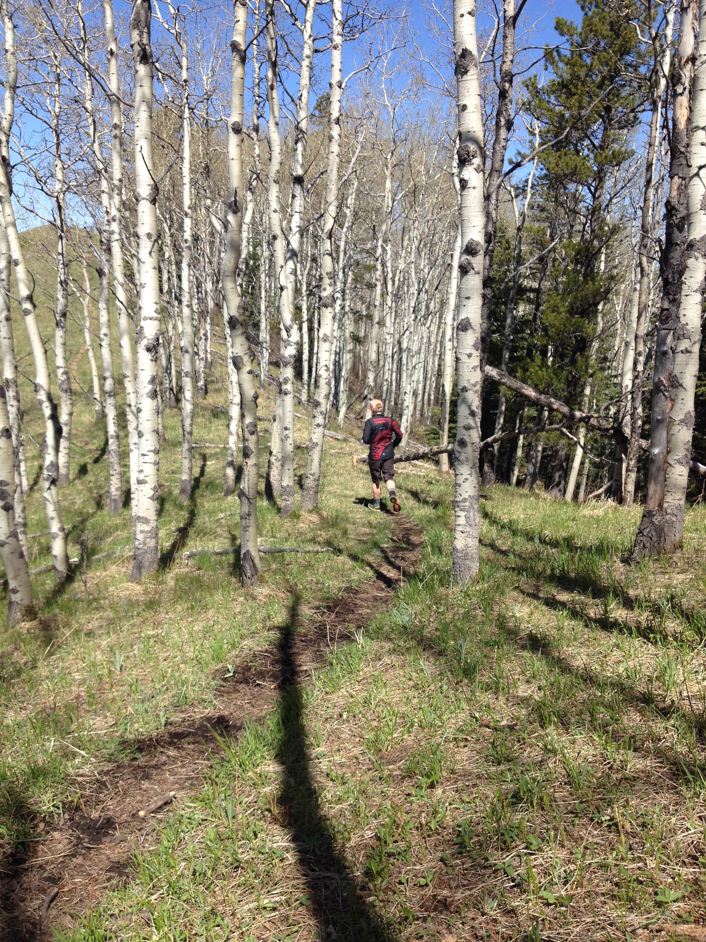
The Long event on September 20th will start at 10AM on the lovely Sandy McNabb map in the Bluerock Wildland Provincial Park, south of Calgary (Turner Valley). The trees will be changing colour and the area will be spectacular! The map has been updated and is good shape. The main trail net work has all been updated, but some of the indistinct trails are over grown or new ones have sprung up. The forest is very runnable making this excellent orienteering terrain! Directions to the parking are here: Sheep River Park Headquarters.
Parking - The Sheep River Park Headquarters parking lot. First parking lot on your right (North) as you come in to the park. The parking lot is not huge, so please carpool if you can.
To obtain the required permit we have had to split the the event so that Courses 5, 6 and 7 are entirely on the North side of the road and Courses 1, 2, 3 and 4 are entirely on the South side of the road.
Starts - The start for Courses 5, 6 and 7 is 450 meters North of the parking lot. The start of Courses 1, 2, 3 and 4 is 400 meters South of the parking lot. Please be very careful crossing the road!!! All courses will have a start punch.
Finishes - The finish for Courses 5, 6 and 7 is on the North side of the road about 200 meters from the parking lot. The finish for Courses 1, 2, 3 and 4 is on the South side of the road about 200 meters from the parking lot. Please be very careful crossing the road!!!
Toilets - At the parking lot.
- START: First start will be at 10AM; Start window closes at NOON.
- Start punch will be used.
- Start when ready at discretion of Start Chief.
- 3 competitors (on different courses) can start at the same time.
- Course closes at 3PM.
The courses lengths has not been confirmed yet, but they should be something close to this:
Course 1 - 2.8 km - W12, M12
Course 2 - 2.8 km - W13-14, M13-14
Course 3 - 3.7 km - W15-16, M15-16
Course 4 - 3.6 km - W65-74,W75+, M75+
Course 5 - 5.5 km - W55-64, M65-74
Course 6 - 7.1 km - W17-20, M17-20, W45-54, M45-54, M55-64
Course 7 - 8.4 km - W21-34E, M21-34E, W35-44, M35-44
The Map Scale: Course 7 will most likely be 1:15000. The scale for Courses 5 and 6 will most likely be 1:10000. The scale for Courses 1- 4 will most likely be 1:7500. Please check back closer to the date of the event, as this may change.
The Park recommendation is to carry bear spray, however this is not mandatory and will be left up to your discretion. To refresh your memory about what to do should you encounter a bear (which we will do our utmost to prevent!), check out Parks Canada's website.