Livelox Replays! Coyote Canyon Forest Training Day Training
July 19th 2025 9:30am - 2:00pm
Organizers: Mark Gibbard (Event Director), Anita Brattland (Organizer)
Map: Coyote Canyon
Due to the extreme rainfall event in June, we had to reschedule this event for July 19th. Welcome!
==============================================
Welcome to a Forest Training Day at Coyote Canyon!
The goal of this training is to practice and improve your forest navigation skills and to help prepare for the Western Canadian Orienteering Championships which will be held on a nearby map in August 2025. All courses at this training event will be set at the hardest Technical Difficulty 5 (TD5); there will be no beginner or intermediate level courses for this event.
This is an training day for (1) Adult Advanced Orienteers who want to continue to improve their skills on TD5 courses in complex terrain and (2) Adult Intermediate Orienteers who are already quite experienced at intermediate-level (TD3) orienteering in urban parks/forests and now want to advance their orienteering skills and try TD5 courses with mostly off-trail navigation through forest to find controls on smaller terrain features (eg. small hills, spurs, re-entrants and marshes). We will have a limited number of club members who can help shadow/coach experienced intermediate adult orienteers who are newer to advanced (TD5) forest orienteering. Please let us know in advance if you require additional coaching.
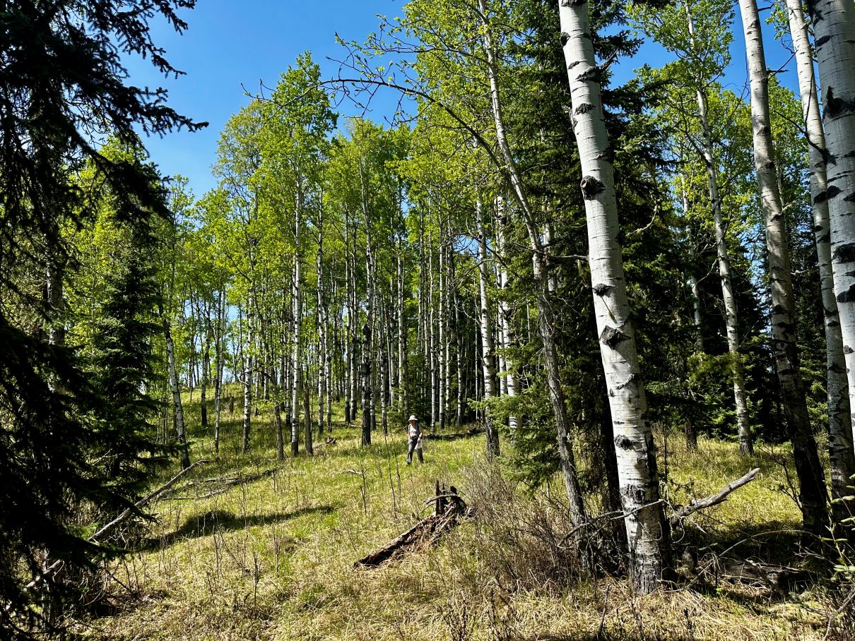
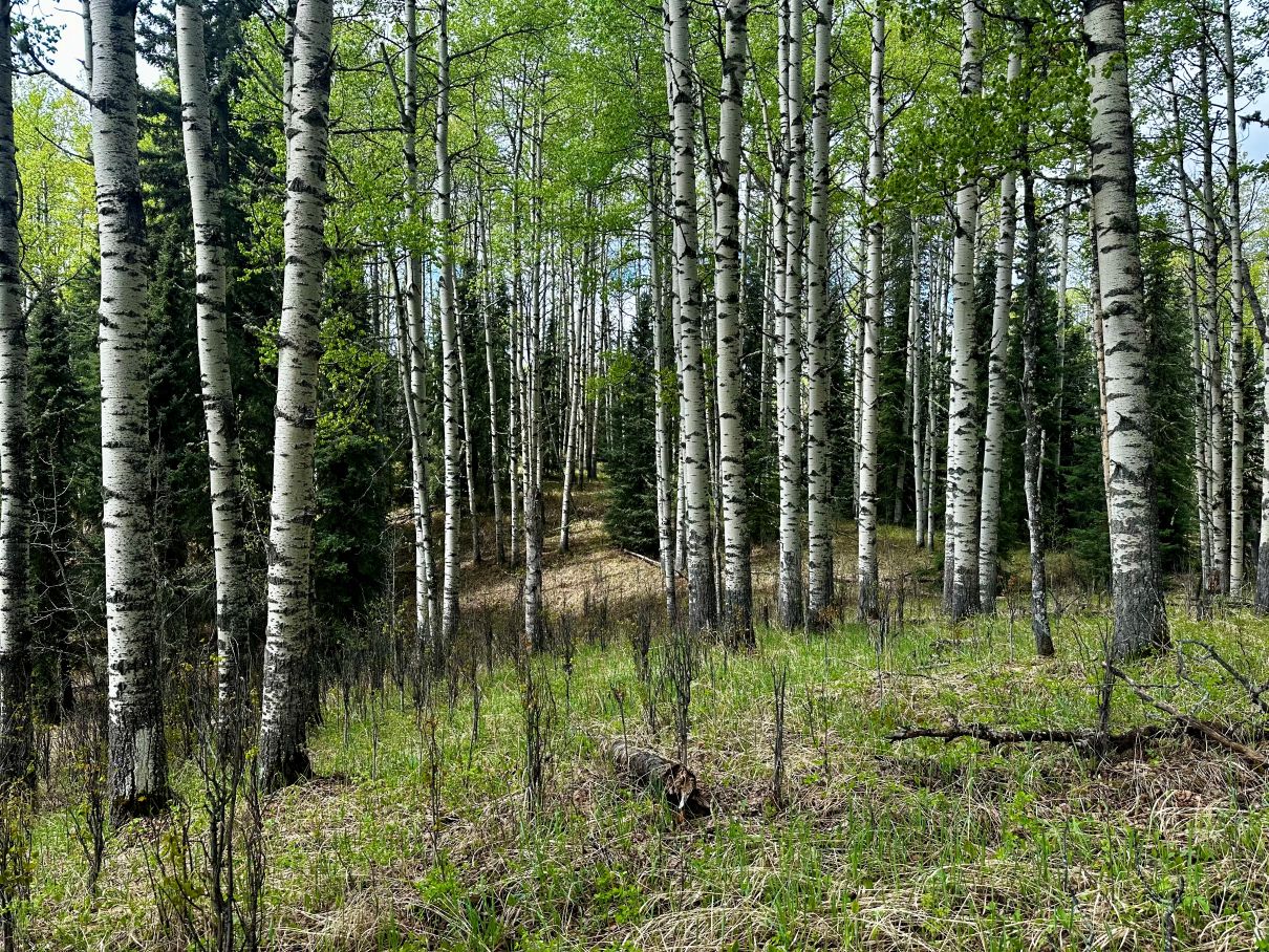
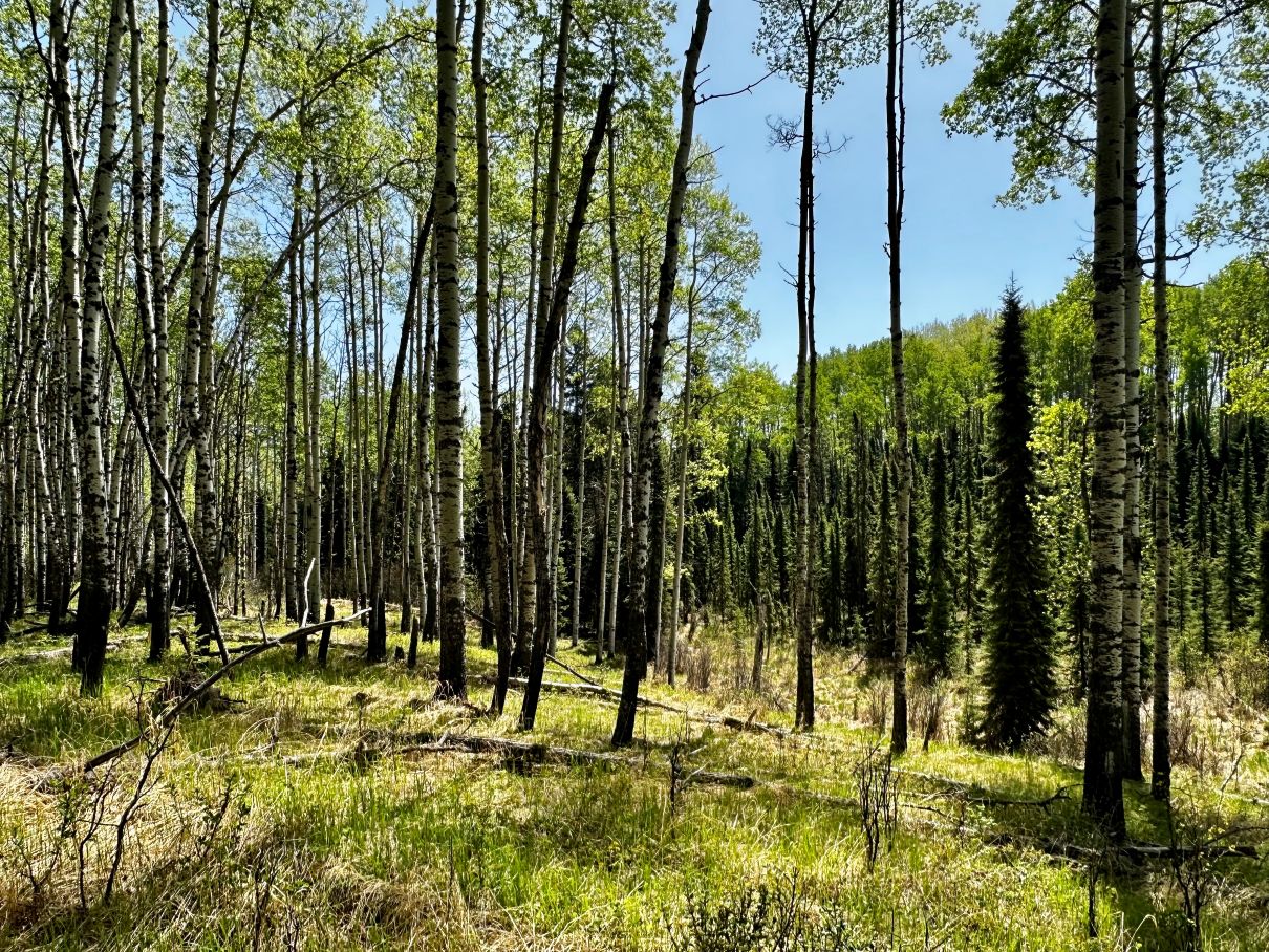
Map: We will be using the southwest part of the Coyote Canyon Map (5m contours, printed at a scale of 1:7500). This rarely-used map has some very interesting technical orienteering terrain including many complex lines of subtle hills and ridges (5-15m high), often surrounded by marshland. The small hills are mostly covered in open aspen poplar / balsam poplar forest with conifers on the lower parts of the hills and around the periphery of marshes (Scroll down to photos below!). The marshes are currently very wet, soft & slow and your route choice will likely want to minimize marsh crossings. There are a few rides and fence lines on the map but as these mostly go straight through long lengths of marshland, they are not viable as travel routes.
Schedule for the Day:
9:30am Arrive at the parking area & get ready to orienteer! The parking location is also the location of the start and finish for all courses (and also the lunch location).
10-10:15am Morning Training Session Remarks & Discussion (Navigating subtle hills and ridges)
10:15-11:30am Follow the Terrain: Small Hills & Ridges Training Course (2.6km, 3.4km or 4.3 km, up to 11 controls, TD5, SI Timing). Start and Finish at the parking area.
11:30-12:15pm Lunch
12:15pm Afternoon Training Session Remarks & Discussion (Longer legs in complex terrain)
12:30-2pm Longer Legs Training Course (3.8km, 6 controls, TD5, SI Timing). A few warm-up controls then some longer legs of 600-900m in length. Start and finish at the parking area.
2pm Course Closing, Final Remarks & Discussion
What to bring:
Bring drinking water (we won't have water out on the course, please carry water), your lunch & snacks, your SI stick (we will have some available to borrow), compass, whistle, bear spray, sunscreen, bug spray, mobile phone.
Other Notes:
DIRECTIONS TO EVENT SITE:
Please follow the Directions below (don't follow Google Maps, as Google doesn't know about the many gravel road closures in this area):
Suggest you Print or Screenshot the directions below before you leave as cell phone coverage is marginal near the event site.
Follow Highway 22 (The Cowboy Trail) until its intersection with Township Road 334. Turn and drive West on Township Road 334 for 9.6km until its intersection with Range Road 64. Turn right and drive North along Range Road 64 for 3km until the first big sweeping bend in the road (this is the location of the pin on the google map below). Look out for first orienteering sign here that will point you to turn right onto a narrow gravel road and immediately drive though a closed gate (please open and then PLEASE CLOSE THE GATE AFTER YOU DRIVE THROUGH). Then, following orienteering signs, drive 900m to Event Parking Area.
Cellular Coverage: There is marginal LTE coverage on the tops of hills, no coverage in valleys and marshes. If you have a cell phone, please carry it when you are out on the course if possible.
Land Access: The event is located on a Grazing Lease on Provincial Crown Land. All roads around the map now have locked gates barring access, but we have arranged with the Grazing Leaseholder to unlock one gate for us for Saturday only. PLEASE CLOSE THE GATE AFTER YOU DRIVE THROUGH. Please do not arrive earlier than 9am and make sure you leave the area promptly at the end of the training event, as the perimeter gates will be locked again at the end of the day. No camping at this event. Please leave the area in a better condition than you found it, we rely on maintaining the goodwill of the grazing leaseholder to be able to keep using this map in the future!
SAFETY and CANCELLATION Policies:
- The Coyote Canyon Map is on the edge of BEAR COUNTRY: AOA Bear spray policy is in effect.
- Visit our website for safety recommendations and more information about wildlife risks .
- Please see the AOA Air Quality Policy for event cancelation in case of a wildfire smoke situation.