RESULTS - Prairie Opener @ Rumsey Forest Event
May 10th 2026 10:00am - 2:00pm
Organizers: Tim McLaren (Course Planner), Marsha Fehr (Controller)
Map: Rumsey
UPDATE: Results, split times, and GPS Route Replays are available here on Livelox. Just click Replay, then the 'Table' tab/button for a table of results and split times for each course/class.
No login or GPS is needed to view. But you can optionally create a free account to import a GPS track.
To view routes, click the Replay, Legs, or Duel buttons for different views of uploaded GPX routes.
You can also add your route and compare with others during Orienteering Canada's pilot test of a nationwide Livelox subscription during May and June. If you love Livelox for event analysis and improvement as much as we do, please use it during this pilot test, create a free account, and upload your GPS (GPX) tracks (or connect your Livelox account to your GPS watch account for automatic imports). Orienteering Canada will evaluate the demand for a national Livelox subscription depending on how much it is used in May and June.
Thank you to everyone who came out on this beautiful Spring day in the prairies, especially our many friends from Edmonton. Special thanks to our many volunteers including Tim, Marsha, Don, Jane, Finley, Miles, Erik, Nicki, Damian, Teresa and everyone else who pitched in.


Driving directions:
Google maps: parking area
Please consider carpooling as parking is limited and to limit vehicle traffic on the cattle farm. Flush toilets and snacks are available at the GTI gas station in Trochu. A small tent toilet will be on-site near the parking.
From Calgary (2.5 hours one way): North on Hwy 2, east on Hwy 27, north on Hwy 21 to Trochu, east on Hwy 585 through Trochu and Tolman Bridge, north on Hwy 56 for 10.8 km. Turn right (east) on Township Rd 34-4 (Orienteering sign at this intersection). Drive 3 km on this gravel road to the white farmhouse. Turn right here, follow orienteering signs & flags along a dirt track for about 1.2 km, to the parking area. Avoid any cattle; note that calves can unpredictably jump in front of a moving car! Please drive slowly as the cows are out.
From Edmonton (2 hours 45 min one way): South on Hwy 2, east on Hwy 42, south on Hwy 21 to Trochu, east on Hwy 585 through Trochu and Tolman Bridge, north on Hwy 56 for 11 km. Turn right (east) on Township Rd 344 (Orienteering sign at this intersection). Drive 3 km on this gravel road to the white farmhouse. Turn right here, follow orienteering signs & flags along a dirt track for about 1.2 km, to the parking area. Avoid any cattle; note that calves can unpredictably jump in front of a moving car! Please drive slowly as the cows are out.
Event Details:
- Start: Start any time between 10am and 12 noon.
- Course closing: 2pm
- Maximum time on course: 2 hours (whether or not you complete your course). Organizers will start searching for anyone who has not checked back in by 2pm.
- SI timing: will be used for all courses. SI fingersticks (including a limited number of SI-Air fingersticks) will be available to borrow at check-in.
- Distance from Parking to Start: 250m mostly flat
- Check-in: near parking area
- Whistles are mandatory
- What to bring: water (no water will be provided on courses), snacks (no refreshments will be provided), compass, whistle, SI stick (or borrow one at event). Cell phones are encouraged for safety but may not be used for navigation during a race. Cell coverage may be spotty. Optional: backpack for water, snacks, and extra clothing.
- Legend: there is no legend on the map. A map legend will be posted near the check-in area.
- Map scale: Novice 1:5000; Intermediate: 1:7500; Advanced 1:10,000
- Contour interval 5 m
- Separate control descriptions will be available on Intermediate and Advanced courses. They fit in a standard short description holder.
- Make sure you carry water with you on the course, especially for those on the Long Advanced.
Course Details (distances are straight-line, expect to go at least 10-20% further):
- Novice - Technical Difficulty 2 (TD2): 2 km/50m climb. Not suitable for complete beginners. You should be able to orient yourself and the map to North. We suggest children be shadowed unless they are quite experienced.
- Intermediate - TD3: 4 km/140m climb. You need some understanding of contours.
- Long Advanced - TD5: 8 km/280m climb. The most technically difficult course.
- Short Advanced - TD5: 5.2 km/190m climb. A shorter version of the Long Advanced course.
Course Planners’ Map Notes:
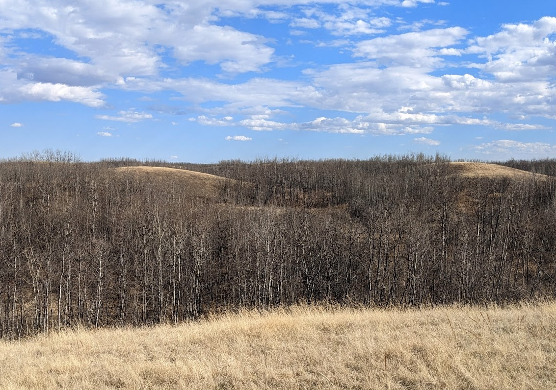
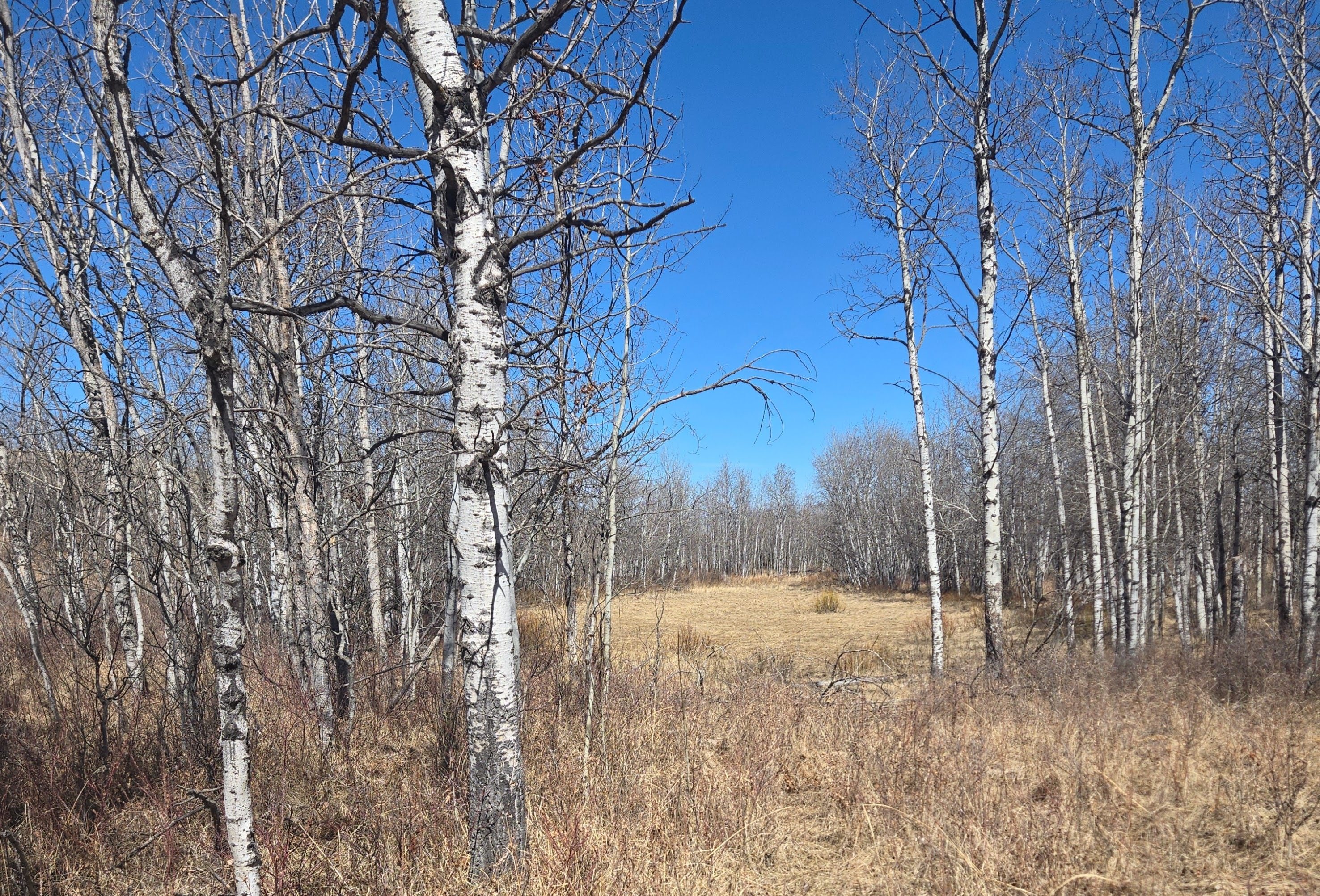
This event is held in the Rumsey Natural Area, a beautiful and unique terrain with lots of similar looking small hills, marshes and varied patches of vegetation. Navigation is considerably more complex than city parks, so you need to concentrate on map reading to prevent getting lost and to reorient yourself if you do lose track of where you are on the map. Feel free to ask for a refresher on map reading before you start your course.
There is a fence surrounding the Novice and Intermediate courses – do not cross the fence. If you need to return to the finish/check-in, follow the safety bearing to the east and then to the north. The advanced courses must cross a fence to the south; to prevent damage, you must roll under it.
Most of the paths are cattle trails and evolve over time. There may be newer unmapped indistinct trails in a few places as well as older trails that are now overgrown. The vegetation mapping is quite reliable although some areas might have newer growth and slightly smaller open areas than shown on the map. Although I have updated most parts of the map, there are still some prominent trees shown as small green circles are no longer prominent. Therefore, you should concentrate on the other types of features while navigating such as the marshes, forest areas, and especially the contours.
We expect the terrain will be dry and highly runnable. On April 20th before the area was hit with the snowstorm, our feet stayed dry throughout and only a couple marshes had any water which was easily avoided. In the trees, the white or green areas (except for dark green fight or undergrowth vertical slashes) are quite runnable although full leg coverings are strongly encouraged due to the scratchy prairie brush). Open (yellow) marshes are typically very flat, dry and fast running although you may be slowed down going through the vegetation surrounding the marshes. Marshes surrounded by a black line are mostly wet and not (safely) crossable.